Hurricane Forecast Points to a Dangerous 2024 Atlantic Season
2024-06-07
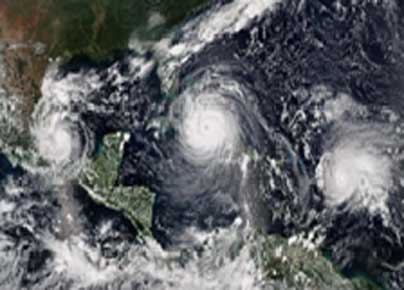
The 2024 Atlantic hurricane season starts on June 1, and forecasters predict an exceptionally active season. If the National Hurricane Center's early May 23 forecast is correct, the North Atlantic could see 17 to 25 named storms, eight to 13 hurricanes, and four to seven major hurricanes by the end of November. That's the highest number of named storms in any NOAA preseason forecast.
Other forecasts for the season have been just as intense. Colorado State University's early outlook, released in April, predicted an average of 23 named storms, 11 hurricanes and five major hurricanes. The European Centre for Medium-Range Weather Forecasts anticipates 21 named storms.
Colorado State also forecasts a whopping 210 accumulated cyclone energy units for 2024; NOAA forecasts the second-highest ACE on record. Accumulated cyclone energy is a score for how active a given season is by combining the intensity and duration of all storms occurring within a given season. Anything over 103 is considered above average. These outlooks place the 2024 season in league with 2020, when so many tropical cyclones formed in the Atlantic that they exhausted the usual list of storm names: A record 30 named storms, 13 hurricanes, and six significant hurricanes formed that year, combining for 245 accumulated cyclone energy units. Forecasters and climatologists look for two main clues when assessing the risks from upcoming Atlantic hurricane seasons: a warm tropical Atlantic Ocean and a calm tropical eastern Pacific Ocean.
Warm Atlantic water can fuel hurricanes. The Atlantic Ocean warms up during the summer, resulting in favourable hurricane conditions. Warm ocean surface water – about 79 degrees Fahrenheit (26 degrees Celsius) and above – increases heat energy, or latent heat, released through evaporation. That latent heat triggers an upward motion, helping form clusters of storm clouds and the rotating circulation that can bring these storms together to form rainbands around a vortex.
Ocean heat in 2024 is a big reason why forecasters warn of a busy hurricane season.
The North Atlantic Sea surface temperature has been shattering heat records for most of the past year, so temperatures are already high and expected to remain high during the summer. Globally, ocean temperatures have been rising as the planet warms.
A long-term temperature pattern known as the Atlantic Multidecadal Oscillation, or AMO, also plays a role. The summer Atlantic Ocean surface can be warmer or cooler than usual for several seasons, sometimes lasting decades.
Warm phases of the AMO mean more energy for hurricanes, while cold phases help suppress hurricane activity by increasing trade wind strength and vertical wind shear. The Atlantic Ocean has been in a warm phase AMO since 1995, which has coincided with an era of highly active Atlantic hurricane seasons.
How the Pacific can interfere with Atlantic storms
It might seem odd to look to the Pacific for clues about Atlantic hurricanes, but Pacific Ocean temperatures also play an essential role in the winds that can affect hurricanes.
Like the Atlantic, water temperatures in the eastern Pacific oscillate between warm and cold phases but on shorter periods. Scientists call this the El Niño Southern Oscillation, or ENSO. The warm phases are known as El Niño, and the cold phases are called La Niña.
La Niña promotes the upward motion of air over the Atlantic, which fuels deeper rain clouds and more intense rainfall.
La Niña's effects also weaken the trade winds, reducing vertical wind shear. Vertical wind shear, a difference in wind strength and direction between the upper atmosphere and the atmosphere near the Earth's surface, makes it harder for hurricanes to form and can pull apart a storm's vortex.
This ocean tag team controls hurricane activity.
Together, the Atlantic and eastern Pacific Ocean temperatures control Atlantic hurricane activity. This is like bouncing in a bounce house or on a trampoline. You get a good bounce when jumping on your own but reach far greater heights when you have one or two more people jumping with you.
When the eastern Pacific is in its cold phase (La Niña), and the Atlantic waters are warm, Atlantic hurricane activity tends to be more frequent, with a higher likelihood of more intense and longer-lived storms.
The record 2020 hurricane season was influenced by La Niña and high Atlantic Ocean temperatures, and forecasters expect the same in 2024.
It is also essential to remember that storms can intensify under moderately unfavourable environments if a warm ocean fuels them. For example, the storm that eventually became Hurricane Dorian in 2019 was surrounded by dry air as it headed into the Caribbean. Still, it rapidly intensified into an extremely destructive Category 5 hurricane over the Bahamas.